Donate to ...................Cancer research ................................or Macmillan

Tuesday, 29 March 2011

And The Bike Training Begins

Spurred on by two great weekends on Cycling Scotland's Cycle Trainer course where I met some interesting and all round good people who also like bikes, I decided that today should be spent on a nice long bike ride. I've been meaning to explore the Deeside Way for ages now, so today I pedalled off to see how far I could get before the sensible part of my brain suggested I come back.

It turns out that the Deeside Way is a really nice ride through the posher, more picturesque parts of Aberdeen and shire. I think the tell-tale sign was that the fields tended to have horses in them rather than stinky, grass munching bovines.

So, I found out that it was around about Banchory that the sensible part of my brain said, "Charlie, do yourself a favour. Eat some lunch and head back before your legs drop off." However, it was rudely interrupted by the daft part of my brain which then said, "Ooh, look at that tower on top of Scolty Hill. It would be rude to visit Banchory and not visit that."

So after some pushing of the bike and polite banter with a group of oldies walking down (Blue rinse #1: oh they don't like those things up here. Blue rinse #2: There's even a no bikes sign at the top. Blue rinse #1: Aye, I saw that too. Tsk!) I made it to the tower and gazed down upon my conquered domain. I know owned everything from the tower to the horizon!

A fine ride and I even got back in time to meet Beth from school. Now that I've had my cuppa, I'd better go and wash the trusty steed.

Did I mention that I made it back from the Tower via the downhill mtb trail with my Michelin Country Rock tyres inflated to 60psi! I didn't intend to take that route but damn it was fun and a good test of technical skills as roots, narrow gaps and mud would have sent me to my death... or at least given me something to moan about for a while!

Here's the route:

The Deeside Way To Banchory

EveryTrail - Find trail maps for California and beyond

Friday, 25 March 2011

Major Changes as Big Adventure Grows Wheels

It would be fair to say that organising a hiking trip across Scotland would take a bit of planning. I suppose that if it included  being completely self sufficient and taking a route over the Cairngorms then the planning gets greater! So, therefore a serious pair of adventurers would certainly ensure at least two weeks off work by booking this time with the boss well in advance. Wouldn't they?

So, moving on, why don't we cycle instead? According to the wise and all-knowingly reliable internet, there is an off-road route from Montrose to Skye which can be done in 6 days. This goes via Ft William after about 4 days. So in the absence of summer holidays, a long weekend would ensure that Scotland's oil links with J.R. Ewing didn't collapse on account of some time off and upon successful application of a small mortgage, I can still just about afford the cost of fuel back to Aberdeen.

So, here it is. The Plan. We, or I, will endeavour to cross Scotland on two wheels rather than two feet (although I think feet are still involved) following a well publicised route. I'm still to buy the actual guide but in case I end up doing it alone,the route passes through civilisation to ensure that the whole six days' worth of supplies does not need to weigh down the bikes and there is regular contact with loved ones.

Here is the rough idea courtesy of Mountain Bike Routes UK except I think we'll do it backwards.


The Scotland Trail route


Start: Skye or Ft William
Finish: Montrose
Distance: 270 miles
Duration: 4-6 days
Split to day rides: in sections & loops
Rail access: Skye, Ft William, Aviemore, Montrose
For more details of previous rides that I have done over the past couple of years, have a look here.

Friday, 25 February 2011

Oooh, gadgets!

Ok, so really this blog should be about documenting the training and progress of our planned journey but having discovered these gadgets I can't resist sharing them. In fact, this could be considered part of our trip wish list and anyone with recession-proof cash burning a whole in their pocket could easily donate to a good cause!

The nPower PEG

I've been looking at ways to keep phones and cameras charged during our time in the hills and have mainly focused on popular solar solutions like the Powermonkey Explorer. However, even in the Summer there are obvious disadvantages with relying on the sun.

The nPower PEG is the first portable power solution to efficiently harness kinetic energy to store a charge. It looks fantastic. All you do is stick it in your rucksack and day or night, it harvests the energy from your motion. As yet, there is not a RRP for the UK but it's expected to set you back about £100 or so. It can generate enough power to charge mobile phones for talktime, iPods and even iPads. It cannot generate enough charge for a laptop but then who's likely to take a laptop out into the wilderness?

I definitely think there is something to be said for being out in the wilderness, away from the ties to technology. However, I am considering this for the importance of safety and so that we can check in occasionally with loved ones. Being able to be tracked via GPS would also add an interesting element to the documentation of our trip, which brings me on to the next gadget...

The SPOT Connect

This is a clever little gizmo that allow GPS data, social network updates and emergency requests by using satellite rather than mobile network. By downloading the smartphone app and linking the phone and SPOT Connect together via bluetooth, you can stay in touch in remote areas.

Having just read Between A Rock And A Hard Place (now a Danny Boyle film called 127 Hours) I can understand the terrible risks that being in the middle of nowhere can pose. Aron Ralston made the schoolboy error of not letting anyone know where he was going when he set off to explore remote canyons in Utah. He became trapped by a boulder and gradually accepted his likely demise over 127 hours before cutting his arm off to escape.

What Aron could have benefited from was a device that allows a message to be sent to an international rescue centre where help could be dispatched to accurate coordinates. Maybe he could have sent help requests to friends and family with a less urgent but equally helpful feature of the gizmo. Or maybe he could have updated his facebook or twitter status as "Aron is not enjoying being squashed by a boulder. ...like?)

Anyway, this does seem like an interesting piece of kit and, although I imagine it's very power hungry, quite possible worth it for piece of mind as well as up-to-date publicising of the progress of a hike across Scotland.

Monday, 7 February 2011

The Gordon Way 24hr Double

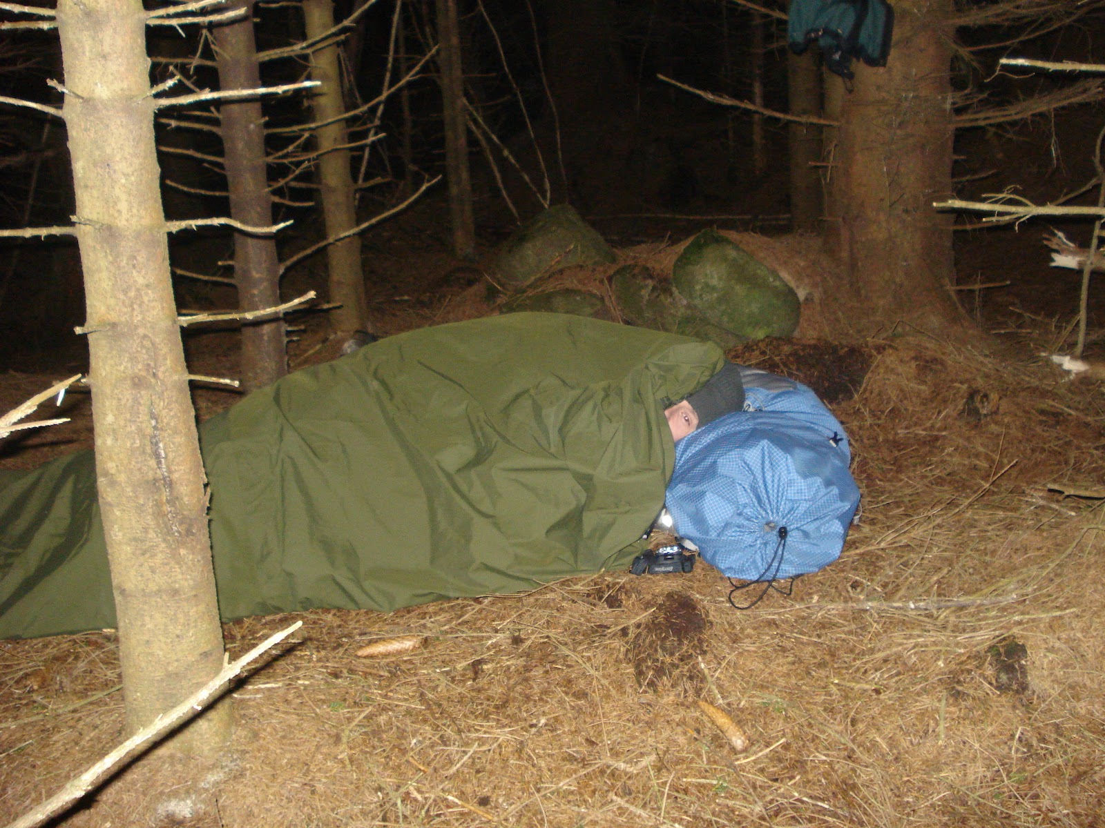
Most people like to end their week with a DVD, glass of wine and maybe even a sensual foot massage from a mysterious stranger whilst eating Turkish Delight from a silver tray. Not us! There's nothing more appealing to us than the thought of hiking all through the night, sleeping rough in a waterproof sack before doing it all again the next morning. In fact, you can see the eagerness in our faces!

After waiting what seemed like an eternity for Will to finish working ('working' from home - who actually does any work?) and the threat of Will having to pop into Aberdeen, we packed the car and set off... half a mile down the road to the Carriages Public Bar. As I watched Will sink a pint and two whiskies, I couldn't help but wonder whether my abstinence was actually part of my training or not. Maybe he knew something I didn't! Anyway, we finally pulled up at Suie Hill's car park and sorted ourselves out. Bearing in mind, our trip to Lochnagar had been snowed off and the forecast here was windy and wet, I dressed in my Tesco's sweat-retaining, waterproof trousers and my brilliant and gratefully received, wind and waterproof hand-me-down jacket. Will wore his trousers and fleece. Am I taking all this a little too seriously so far?

So, at 8pm we hiked over Suie Hill, Knock Saul and Satter Hill in what seemed like no time. This was the first time that I'd hiked across from this direction and was rapidly being lulled into a false sense of security, otherwise known as cockiness.

That sense of cockiness was short lived as Will suggested we stop for a food break at the old barn. It's an empty shell of a building with small windows and lots of small doorways leading to other parts of the building. Surrounded by long grass, it's not the most inviting place and I found it got less and less inviting as I joked about encounters with Leatherface and other such retro psycho killers. Suddenly, I decided that I had lots of energy. "We don't really want to stop do we? Lets just carry on.)

After some refreshments we hit the trail to Bennachie. Walking in the dark had it's pros and cons. On the up-side, not being able to see the horizon by tilting your head 60degrees skyward and squinting provides an ignorance to the distance that I can happily live with. On the other hand, I almost missed a small bridge and was close to getting very wet. Will later did the same but he was trying to find a song on his iPod so it really was his own fault.

It was soon after this that Will spotted Pixie Heaven, a secret land within the thick pine trees where the pixies had provided a luxurious bivvy spot for us to rest our weary legs. Being just over half way into the hike, it wasn't quite in the right place, so we pushed on. As we walked over Bennachie, I made the mistake of complaining about my tender groin. Will took this as a good reason to head back to Pixie Heaven. He was obsessed like a man onto a good thing at a pixie disco! It took all my weary strength to keep him going. Maybe I'm being harsh with the pixie disco comments. He seemed genuinely concerned about my groin.. which was nice.


We eventually scuffed our aching legs down Bennachie towards the Esson's car park looking hopefully for another Pixie Heaven. We found a close second in the trees and after some organising of kit, set our heads down for the night. As I drifted off to sleep a listened to the soothing sound of a small burn flowing nearby. I listened to the wind, gently whistling through the high peaks of wood. I watched the gentle sway of the trees as they move to and fro. And I though... what if one were to fall down while we slept?


The following morning we got up and cooked an appetising breakfast of bacon and squirty cheese and herb paste inside a soft white bap. Washing it down with a nice cuppa, one sugar and some powdered milk and we were on our way.

I discovered that several hours in a plastic bag does nothing to repair a man after a 12mile hike, nor prepare a man for another 12mile hike straight away. No amount of stretching would ease my muscles into what turned into quite a gruelling walk. The pack wasn't getting any lighter. It was still 30lbs and felt every ounce of it!

We walked and walked and were lucky enough to bump into an employee of Historic Scotland who distracted me from the pain in my legs by talking about all the ancient stones in the area. He was away up Satter Hill to have a look at an ancient stone. We decided to crack on, and I felt my knees again.


Marking waypoints in the mind provides a useful checkpoint. We stopped for a rest knowing that there were only three hills to go before we arrived at the car. Knock Saul and Suie Hill are both short but killer climbs and as we began to drop into the tree-lined path to the car park, our spirits lifted and we expected to see the car at every turn. The light was fading quickly, and the car park was being very elusive. It was like the old pull-focus in films where the depth of field gives the illusion that the wall is moving ever farther away. Nevertheless, we finally got back to the car and luckily it wasn't stuck in the icy car park. Neither of us fancied trying to push it out!

Ps, we did stop at Pixie Heaven on the way back and Will enjoyed froliking with the pixies. We managed to catch it on camera. Look closely and you might even spot a pixie!


Monday, 1 November 2010

Camping in Paradise Woods

 
With wet weather, Paradise Woods was the perfect place to camp with it’s large canopies to shield the rain and a great little camp fire. I got a chance to try out my new tent and Will got a reason to drink his namesake beer, the William Wallace! A great evening, all that was missing was the marshmallows. Shame on you ASDA for not stacking your shelves quickly enough!

Sunday, 24 October 2010

BTW – Araldite doesn’t fix walking boots!

 
So it turns out that Araldite doesn’t fix boots. It’s not surprising that my walking boots let in water, I’ve had them for 3 years and they’ve done some hard walking at times. However, they let in water after the third outing so really I should have done something about it by now!
But wait, this post is not really about my boots. It is really about my latest training hike. 15 miles and 3700ft total elevation was more than I’d expected to do but I discovered two things today. a) that I like my own company (I knew that already) and b) that sometimes when a person starts walking solo it’s really difficult to stop!
I started from the Bennachie Centre near Chapel of Garioch and hiked up the steep ascent to Mither Tap. From there I walked across to Craigshannoch and on to Oxen Craig. I accidentally took the wrone path and missed Little Oxen Craig but didn’t think it was worth worrying about this time. From there I headed down to the same mysterious peak that Will and I got lost on last time and instead of doubling back, I headed straight over and joined the Gordon Way. This is where my adventure really started. I learnt a further two things about myself. c) I am not Bear Grylls when it comes to common sense navigation and d) I should know better!
Not wanting to descend too much down the wrong side of Bennachie, I eventually followed a path which seemed to go back in the direction I came from. I took this wide and fairly well trampled path in the hope that I would sweep down along the line of trees and rejoin the Gordon Way in the correct direction later. Instead it stopped dead! So I checked my compass to take bearing of which direction I was supposed to be heading and dropped down into the trees with the fairly assured assumption that most forests seem to have a gap running down and a network of fire roads that I would soon be able to pick up and head towards my destination.
And so I found myself sheepishly trampling through the heather back up the side of the mountain, out of the trees and into a blizzard of sleet! My detour into the forest had only given me a labyrinth of mossy, boggy routes to dead ends and so I had decided to cut my losses and follow the fence back towards the style which I know crossed the Gordon Way.
After 5 hours of walking I was back at the car park to pick up my 3pm lift… which wasn’t there. So I decided to walk along the road and meet in en-route. An hour later, my weary legs finally stepped into a warm car. A good training day but a few more needed before I’ll be able to do even two in a row, let alone two weeks.
Charlie
Total Distance: 24.40 km (15.2 mi)
Total Time: 5:57:13
Moving Time: 4:33:18
Average Speed: 4.10 km/h (2.5 mi/h)
Average Moving Speed: 5.36 km/h (3.3 mi/h)
Max Speed: 14.51 km/h (9.0 mi/h)
Min Elevation: 168 m (551 ft)
Max Elevation: 584 m (1916 ft)
Elevation Gain: 1132 m (3713 ft)
Max Grade: 0 %
Min Grade: 0 %
Recorded: Sun Oct 24 09:49:58 GMT+01:00 2010
Activity type: walking
View Bennachie Hike in a larger map

Saturday, 23 October 2010

First two charities announced

We are proud to announce the two main charities that we will support during our adventure across Scotland. We were pretty sure about these charities from the offset. There will be two other charities that we will raise for but as yet they have not been completely decided. There are a number of people and small organisations that have made a real difference. We’ll announce the two chosen shortly.